

DRONE SERVICES

Aerial Photography & Video
Professional aerial photography and video services that provide clear, compelling perspectives from above.
Using high-resolution drone platforms, we capture photos and video that showcase properties, land, and projects in ways that ground-based imagery cannot. Aerial imagery is ideal for marketing, documentation, and visual storytelling, helping clients communicate scale, layout, and surroundings effectively.
This service is commonly used for real estate listings, property marketing, land promotion, and general visual documentation. Deliverables are optimized for digital use and can be tailored to meet specific project goals.
Common applications:
Real estate marketing | property visuals |
land promotion | commercial media |
documentation imagery

Inspection Services (Visual Only)
Safe, efficient visual inspections of structures and facilities using drone technology.
Drone-based inspections provide a non-intrusive way to visually assess roofs, façades, and other hard-to-reach areas without the need for scaffolding, lifts, or ladders. This approach improves safety, reduces disruption, and delivers clear imagery for review and planning.
Inspection services focus on visual documentation only and are intended to support maintenance planning, condition monitoring, and record-keeping.
Common applications:
Roof inspections | building exteriors | facilities | industrial structures | visual condition documentation

Construction Progress Monitoring
Consistent aerial documentation to track construction progress throughout a project’s lifecycle.
Construction progress monitoring provides clear visual updates that help contractors, developers, and stakeholders understand site conditions over time. Periodic drone flights capture consistent viewpoints that can be compared across weeks or months, supporting reporting, coordination, and planning.
This service is ideal for projects that benefit from regular visual records without disrupting active operations.
Common applications:
Construction progress tracking | stakeholder updates | project documentation | timeline visuals
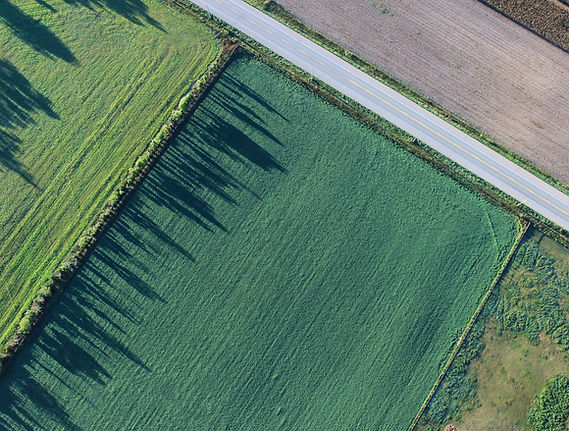
Land & Property Documentation
Comprehensive aerial documentation of land and property for planning, marketing, and records.
Land and property documentation provides a clear visual record of acreage, terrain features, access points, and surrounding context. High-resolution aerial imagery helps landowners, developers, and real estate professionals better communicate site characteristics and evaluate opportunities.
This service offers a cost-effective alternative to extensive ground documentation when visual clarity is the primary goal.
Common applications:
Land listings | acreage documentation | development planning | property records |
site context imagery

2D Mapping & Orthomosaic Imagery
2D orthomosaic maps are created by stitching together multiple aerial images into a single, high-resolution map. These maps offer a consistent visual reference for understanding site layout, features, and overall scale.
Orthomosaic imagery is well suited for planning, documentation, and visualization purposes where accurate visual context is required.
Common applications:
Site overviews | planning visuals | property documentation | construction reference imagery

3D Modeling & Data Collection
Advanced aerial data capture to create detailed 3D visualizations of sites and structures.
3D modeling services transform aerial imagery into textured models and visual datasets that help clients better understand complex sites. These models provide valuable perspective for planning, presentations, and documentation, especially for large or irregular properties.
This service supports visualization and communication by allowing sites to be viewed, shared, and revisited digitally.
Common applications:
3D site visualization | planning support | construction documentation | volumetric visualization (visual reference)

Asset & Facility Documentation
Visual documentation of assets and facilities to support records, planning, and reporting.
Aerial imagery provides an efficient way to document facilities, layouts, and site conditions from a comprehensive perspective. This service is useful for property managers, facility operators, and organizations that need up-to-date visual records.
Common applications:
Facility documentation | asset records | site condition visuals | planning reference imagery
Why Choose Ares Drones
1
Professional Expertise
Built on a foundation of geological science and field operations experience, ARES DRONES, LLC combines technical knowledge with modern aerial innovation.
2
Precision & Safety
Every mission is executed with scientific accuracy and FAA-compliant safety protocols.
3
Customer-Focused Service
We tailor each deliverable to meet your project’s specific goals and requirements.
Areas We Serve
Proudly serving Houston, Fort Bend County, Sugar Land, Richmond, Rosenberg, Katy, and surrounding Texas regions.